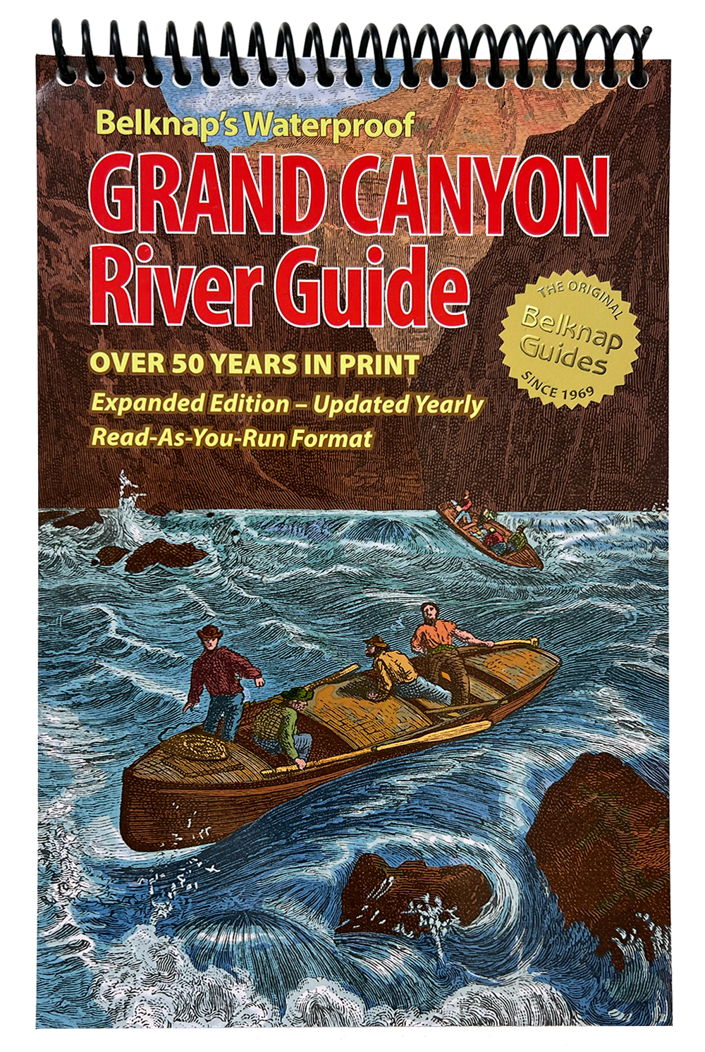
Belknap's Guide to the Colorado River through Grand Canyon — Waterproof Colorado River Map
Belknap's Grand Canyon River Guide is the definitive waterproof map and guidebook for rafting the Colorado River from Lees Ferry to Pearce Ferry. Built for private boaters and commercial trips alike, it delivers mile-by-mile coverage of campsites, rapids, side hikes, and scenic highlights — with more detail than any other Grand Canyon river guide.
What's inside:
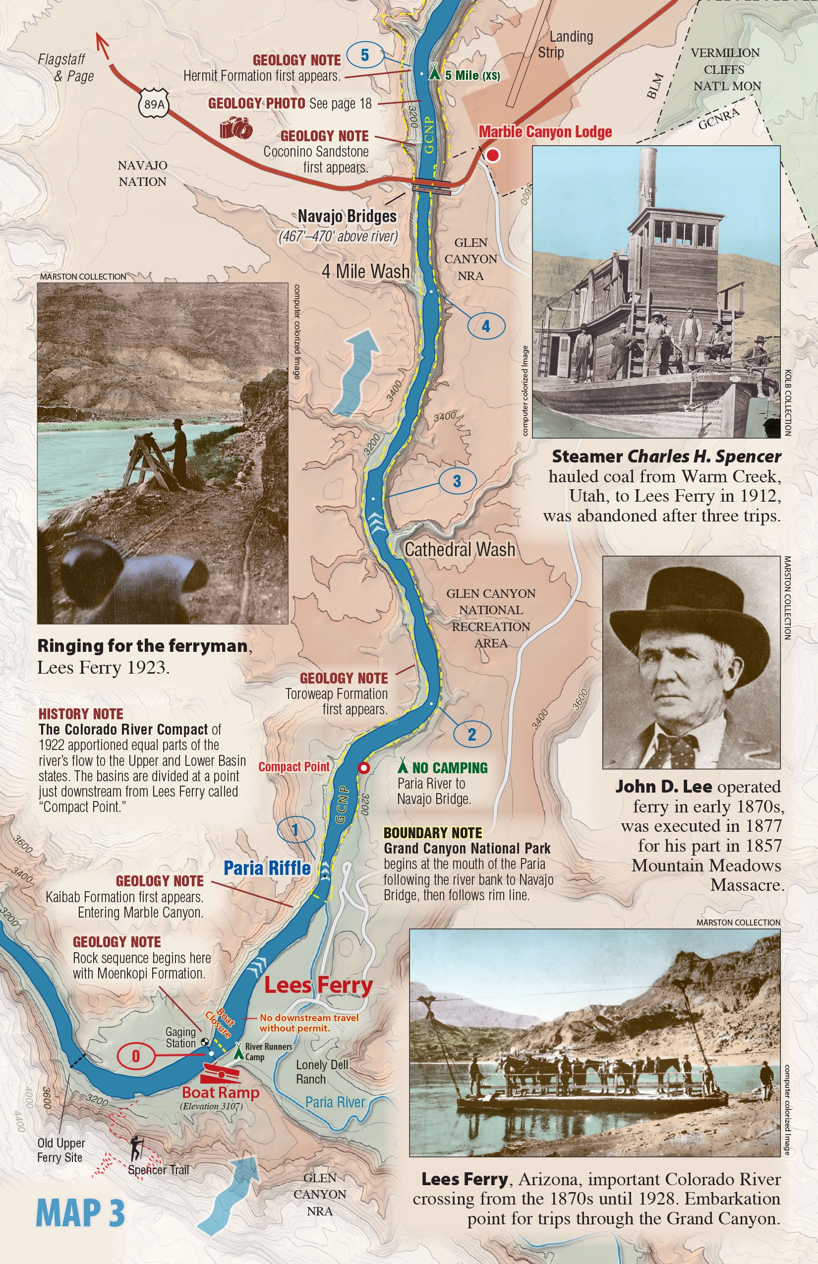
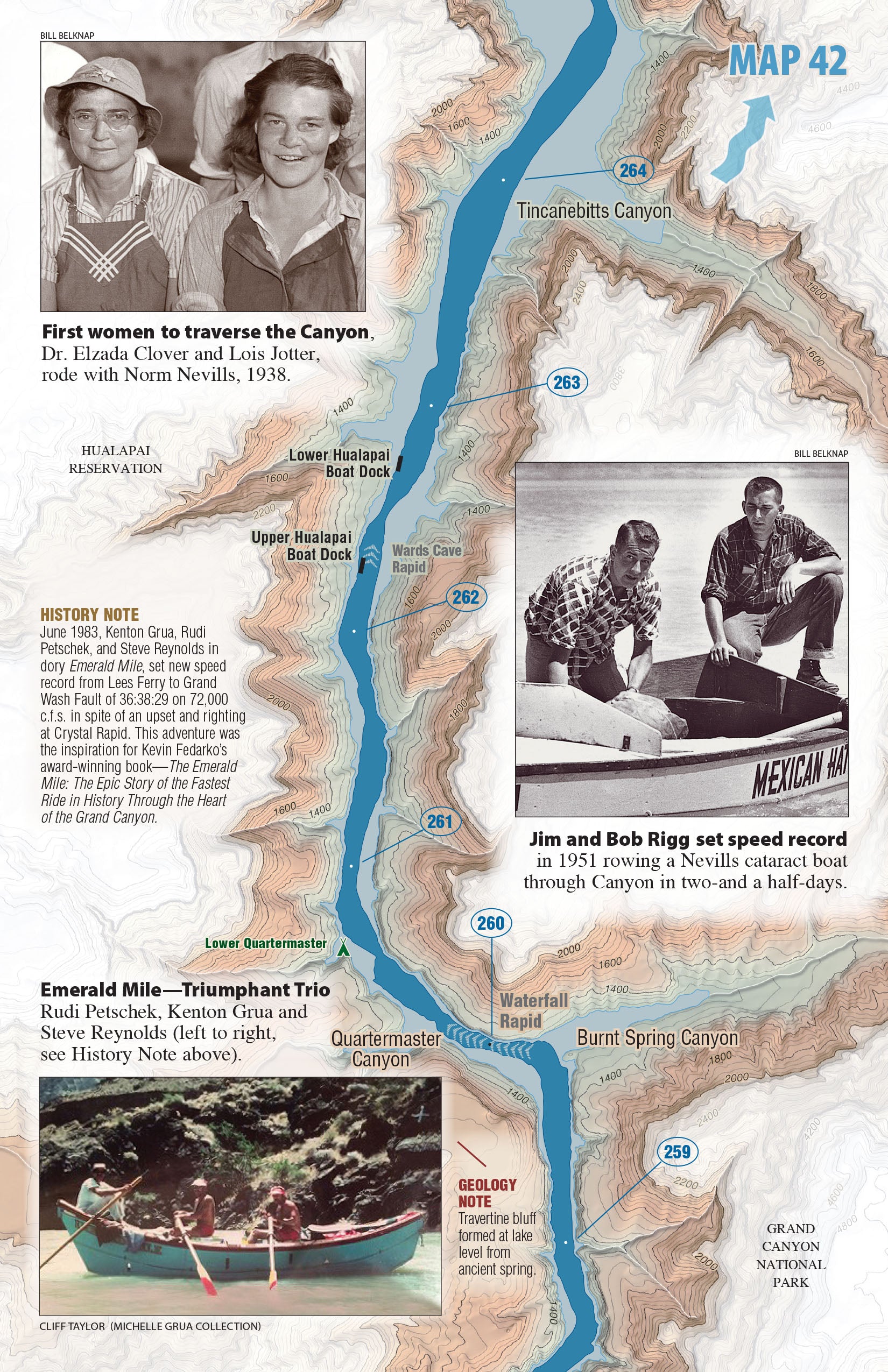
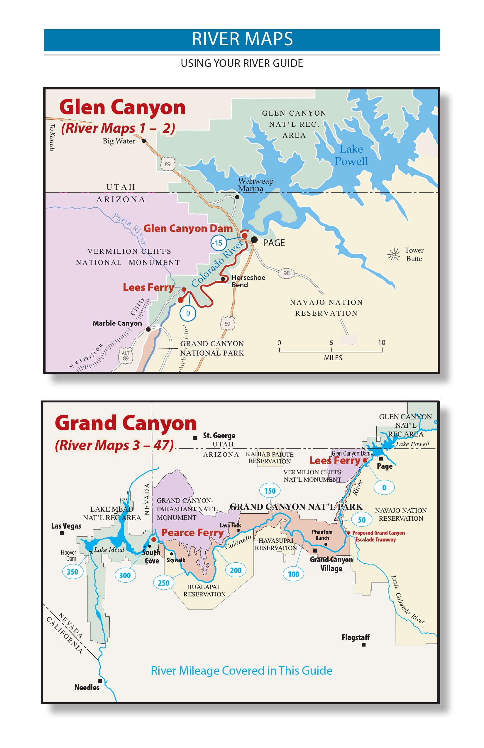
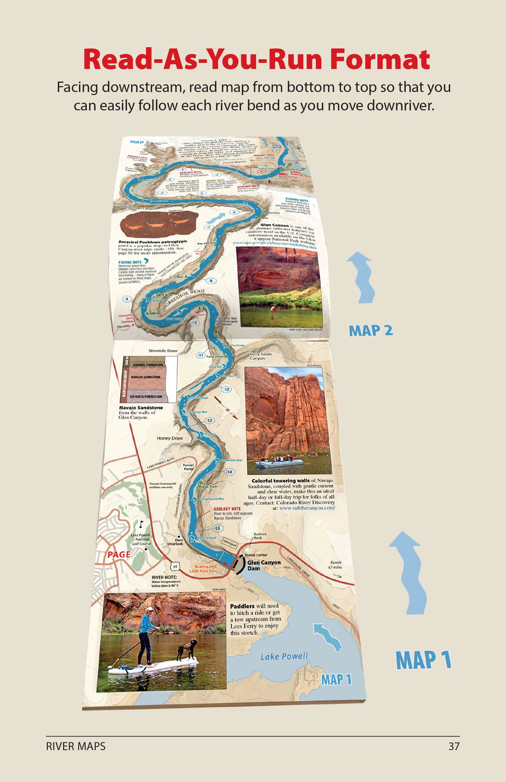
- 47 full-color USGS topo maps with custom shaded relief — 295 miles, Glen Canyon Dam to Pearce Ferry
- Every significant rapid rated on a 1–10 scale plus actual drop in feet (e.g., Hance Rapid: 8–9, Drop 30') — no other guide does this
- Mile-by-mile campsites, side hikes, and points of interest
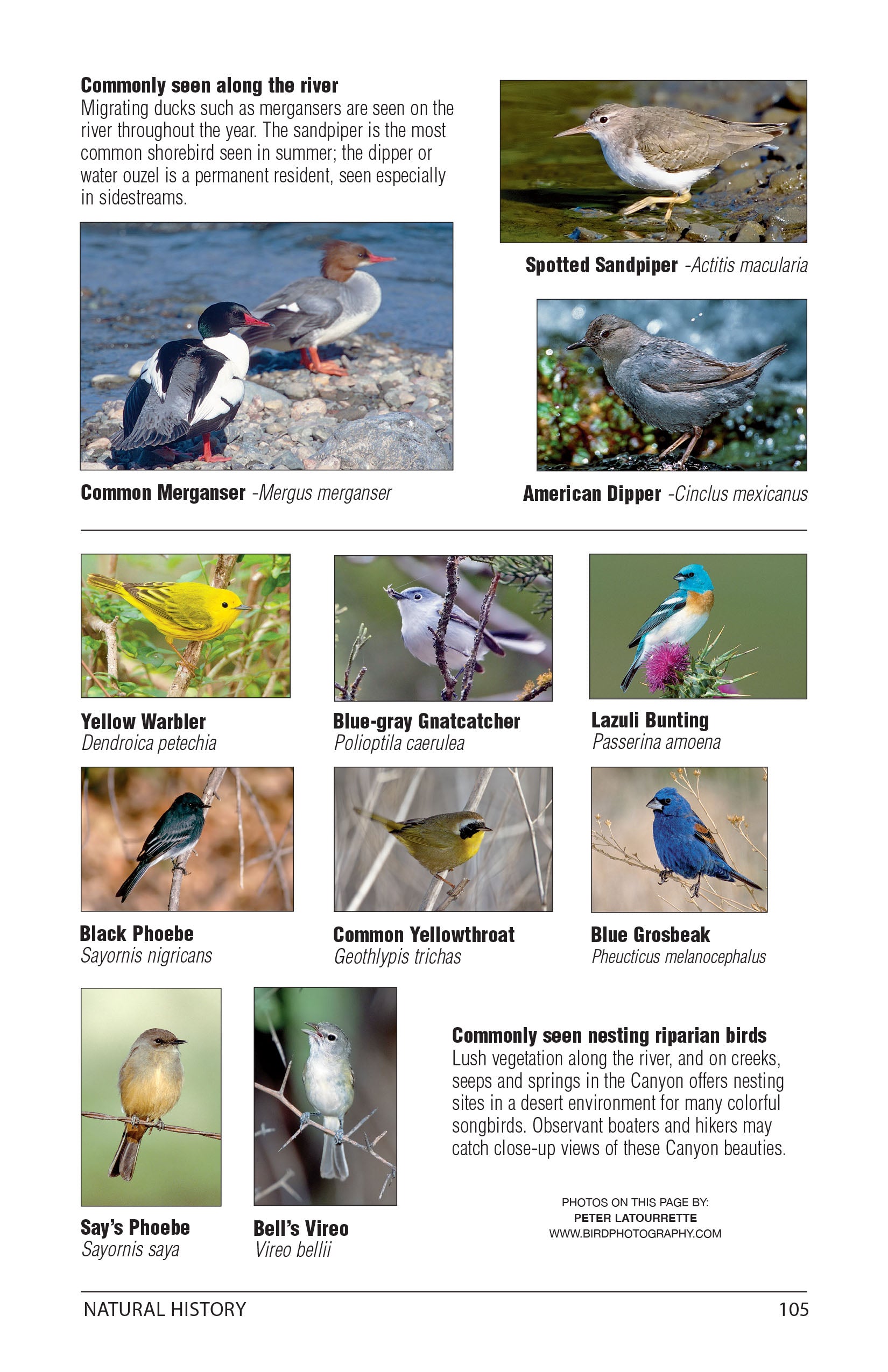
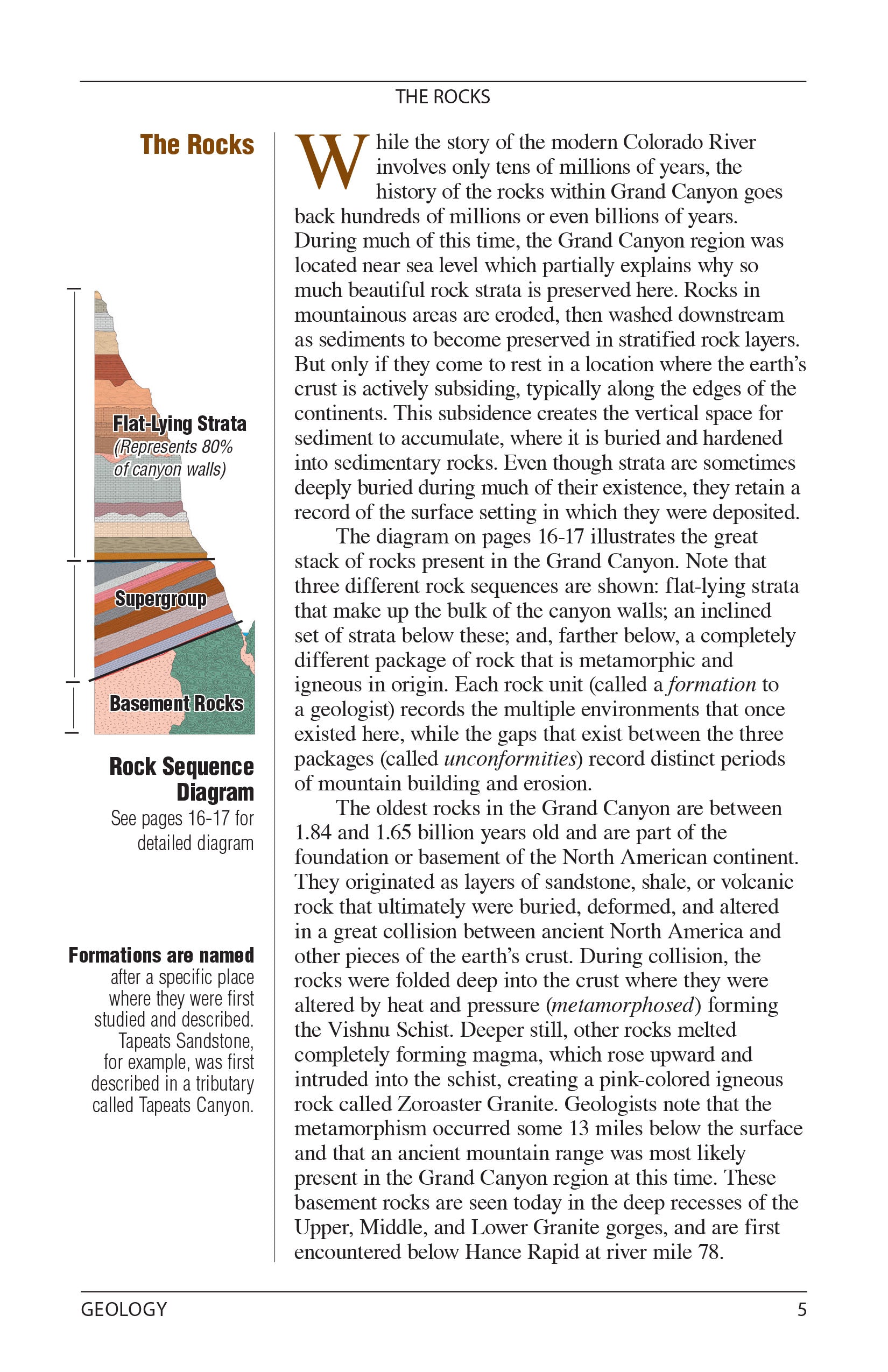
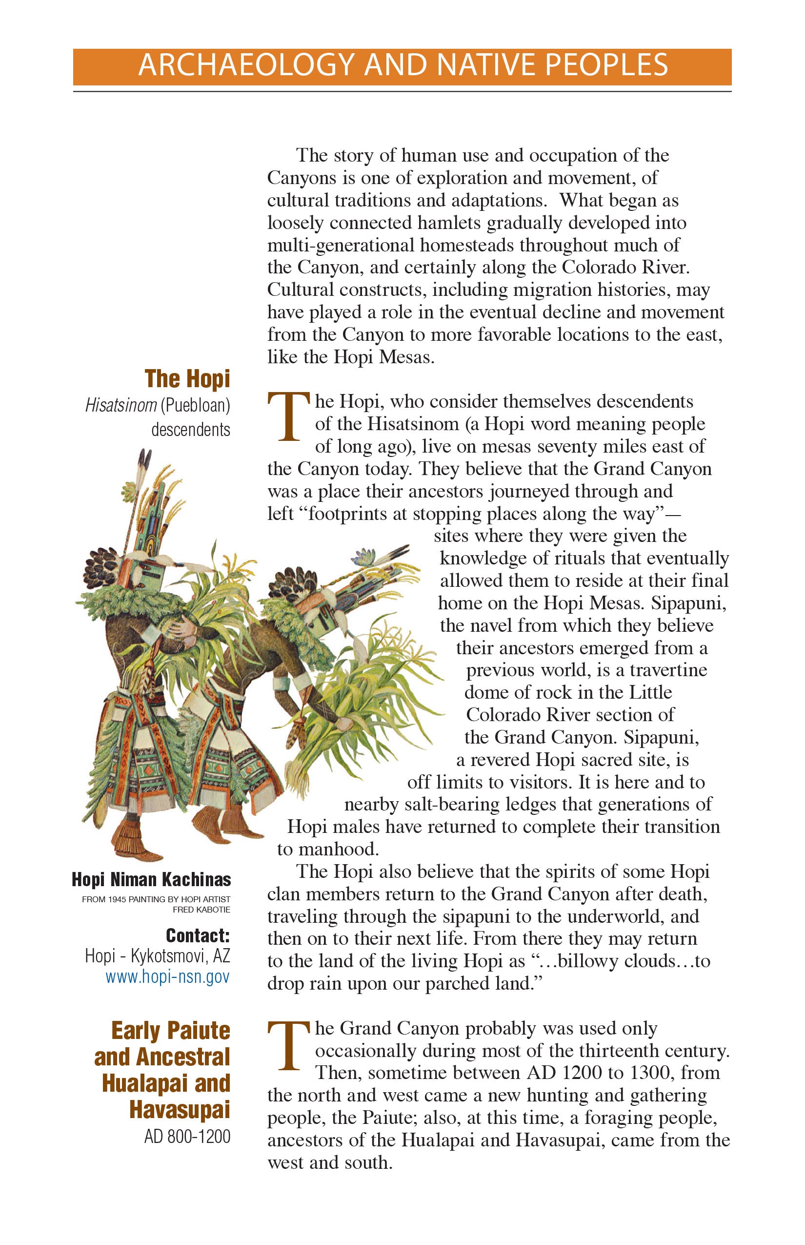
- Grand Canyon history, archaeology, geology, and natural features throughout
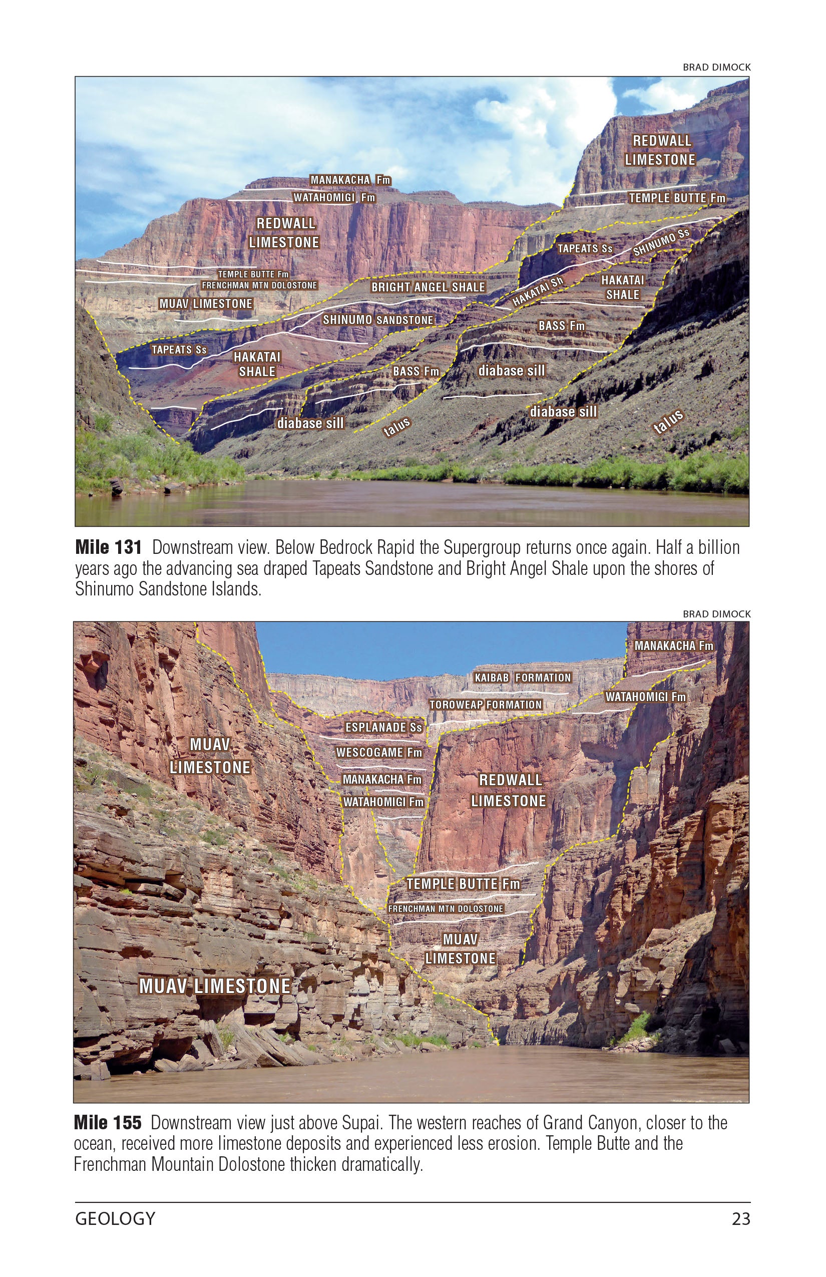
- Photo-labeled geology sections for on-river identification
- Updated annually with current USGS mileage points and campsite data
Built for the river:
- Waterproof, tear-resistant pages — survives multi-day expeditions
- Compact format fits an ammo can — easy to use on the water
- Read-as-you-run orientation — maps flow downstream, no flipping or rotating
- Spiral-bound with stiff covers — lays flat in any conditions
Also available as a digital download on Avenza Maps!