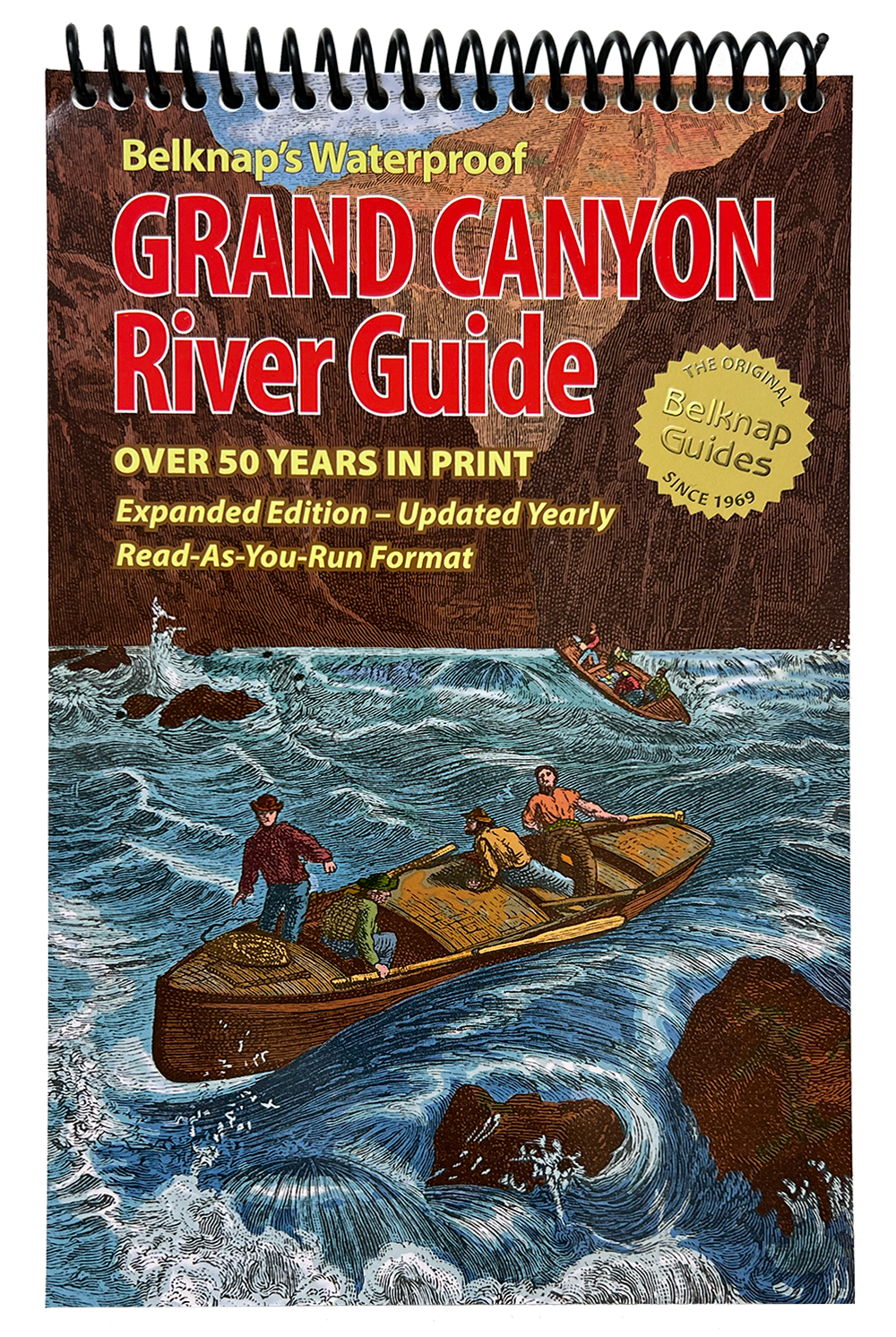


Celebrating 56 years 1969-2025
Explore the West’s Best Rivers with Belknap’s Waterproof River Guides
Westwater Books is the proud publisher of Belknap’s Waterproof River Guides—the original and most trusted river maps for navigating the American West’s most iconic waterways. Since 1969, our durable, full-color river guides have helped thousands of boaters explore the Colorado River through the Grand Canyon, the Green and Yampa Rivers in Dinosaur National Monument, the Colorado and Green Rivers and Cataract Canyon through Canyonlands National Park, and Desolation and Gray Canyons on the Green River.
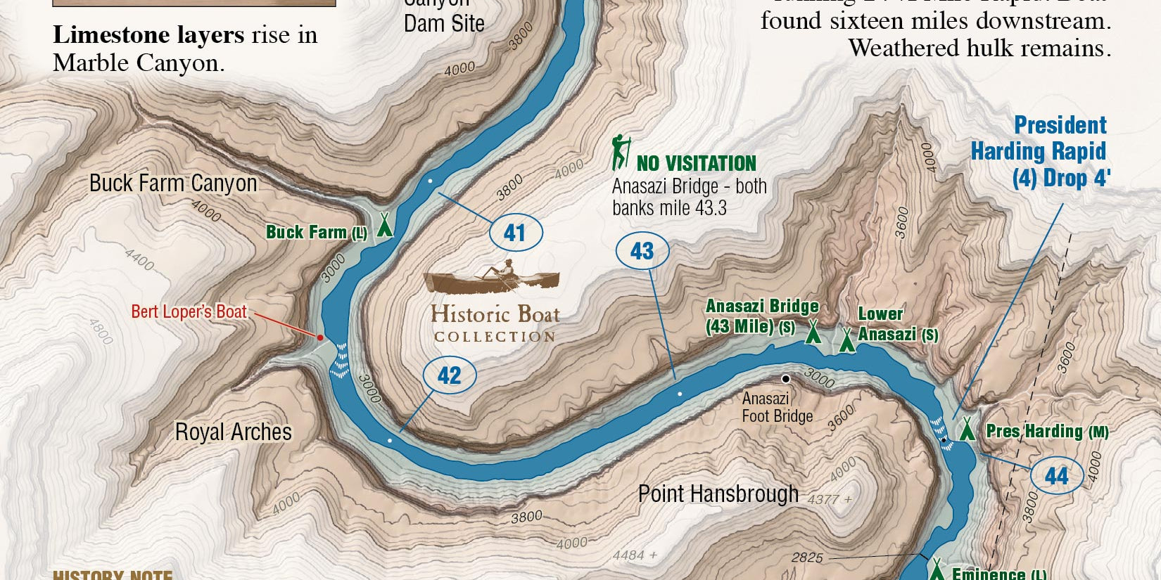
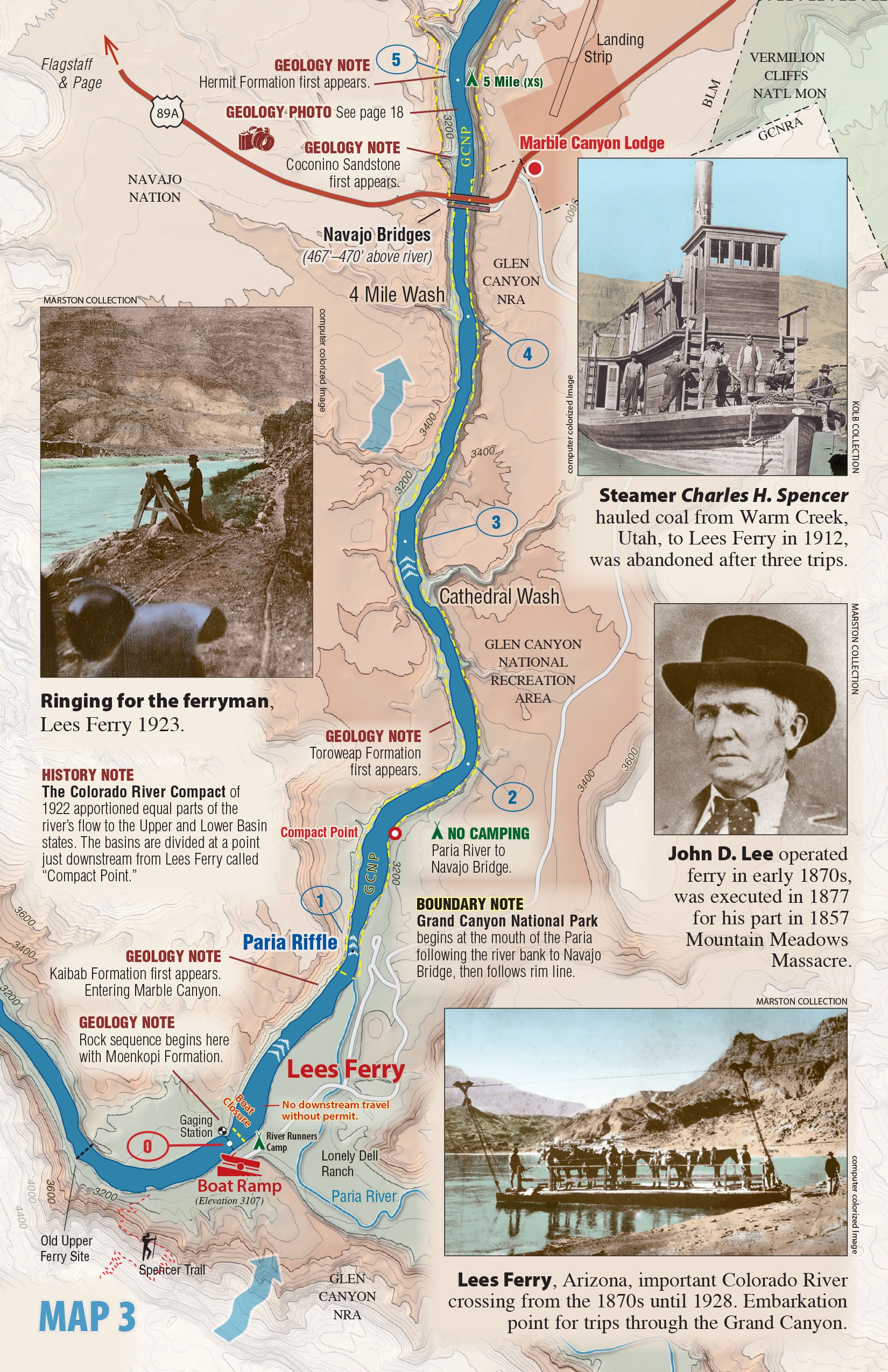
Each guidebook features mile-by-mile river maps highlighting campsites, rapids, side hikes, historical sites, and geological landmarks. Designed for both private trips and commercial outfitters, Belknap’s guides are waterproof, tear-resistant, and built to withstand the rigors of multi-day expeditions.
What sets these guides apart? In addition to clear, easy-to-read topographic maps, each book includes sections on geology, ecology, and cultural history—making your trip not just safer, but far more enriching. Whether you're floating the Colorado River, the Yampa River or the Green River, these guides provide the critical information you need to plan, navigate, and fully enjoy your adventure.
Belknap’s guides are updated regularly and trusted by outfitters, guides, and river enthusiasts across the country. Don’t launch without one—they’re more than maps; they’re essential tools for discovery.
Find your next Grand Canyon River Guide, Dinosaur River Guide, Canyonlands River Guide, or Desolation River Guide right here at WestwaterBooks.com—your source for waterproof river guides made by boaters, for boaters.
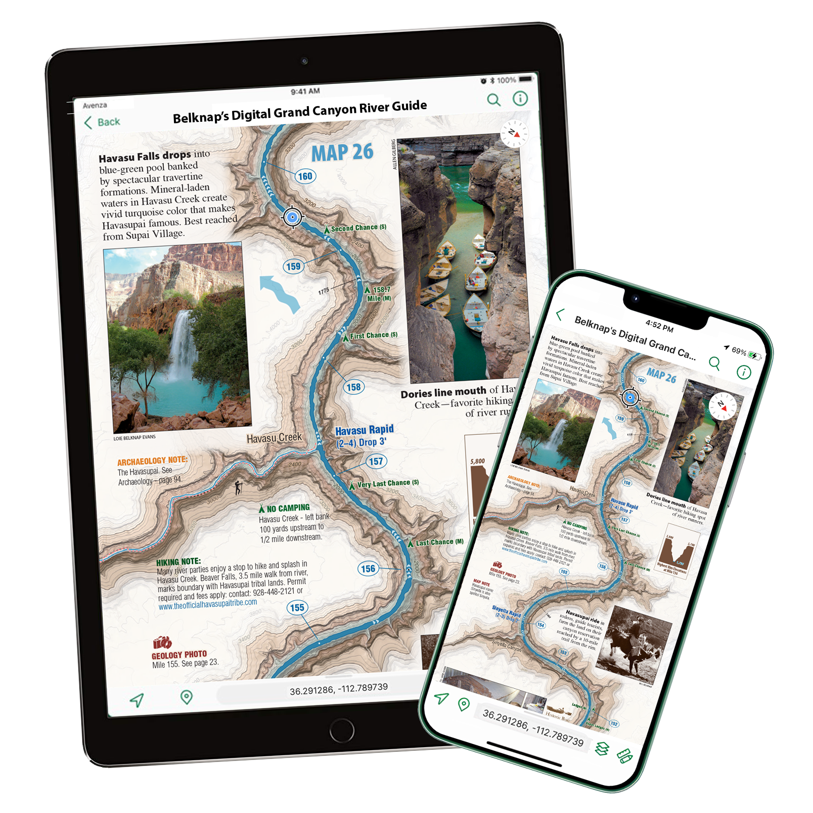
These are digital versions of our best-selling Waterproof River Guides and allow you to track your exact location on the river anytime. As in our print version, the river runs upwards so you can always watch as you head downriver and see all the features on the map. We also show a shaded topo map that extends outside the edges of our map.
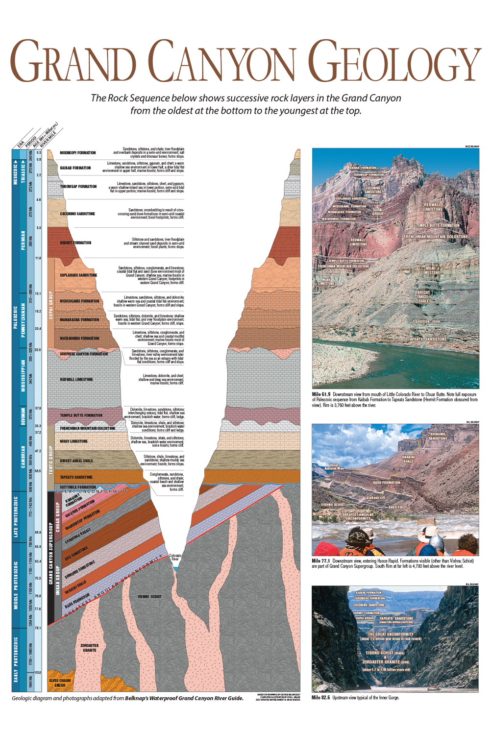
The Grand Canyon Geology Poster is a colorful, updated 18″ × 24″ wall chart illustrating the canyon’s rock layers from rim to river.It features a detailed stratigraphic column alongside river-level photographs, each clearly labeled with formation names for easy identification.This graphic slice of Earth's history is both educational and visually striking, making it a perfect addition to classrooms, offices, or home study spaces.
Available downloads are below for our Grand Canyon River Guide and Canyonlands River guide - as sections (Ruby / Horsethief, Stillwater / Labyrinth and the Moab Daily) or the entire map.


